Amicalola Falls State Park
We traveled to one of the most iconic natural landmarks in Georgia: Amicalola Falls
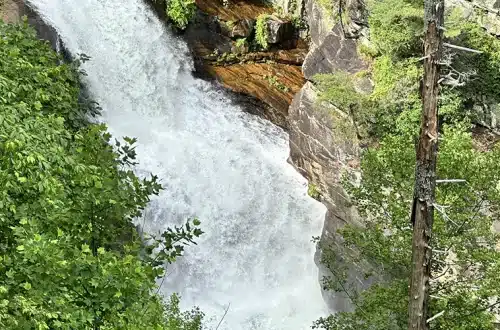
In mid-July, Jesse and I traveled to one of the most iconic natural landmarks in Georgia: Amicalola Falls. This waterfall is located in Amicalola Falls State Park. This waterfall is 729 feet high, is the tallest waterfall in the southeast, and is one of the Seven Natural Wonders of Georgia.
Although Amicalola Falls State Park has a Dawsonville Georgia address, the park itself is 23 miles north of the town in the mountains. We always love a trip to the mountains any time of year, but I especially love a trip in late summer. We visited the park on a Sunday, and you could tell that many other people feel the same way about summer mountain day trips because the park was very crowded. But that’s okay!
Amicalola Falls State Park has 11 hiking trails, ranging in difficulty. There are Easy, Moderate, and Strenuous trails covering 146 miles. Some of the hiking trails lead to destinations outside of the park, including the Appalachian Trail, Woody Gap, and the Len Foote Hike Inn. View the Amicalola Falls State Park Trail Map for reference.
When we got there, it was high 80s/low 90s. We knew ahead of time that if we hiked, it would be a super long hike. There is also no way I can physically take 600+ stairs and then some more hiking to do the entirety of the waterfall (but shout out to those who can!). After reading about all the trails, we decided to do the West Ridge Falls Access Trail. This trail is only .3 miles, but it has a great view of the waterfall.
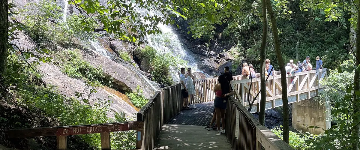
To get to the trail head, you will drive straight up a mountain on the road that is directly across from the Visitor Center. There are signs directing traffic to the lodge, hiking, and Top-of-the-Falls area. Drive up this road and about halfway to the falls you will see a parking lot on the right. This is parking for the West Ridge Falls Access Trail, the Spring Trail, and the Mountain Laurel Trail. Access to the West Ridge Falls Trail is on the far-left side of the parking lot – you’ll know you are in the right place because the trail is covered in shredded recycled tires.
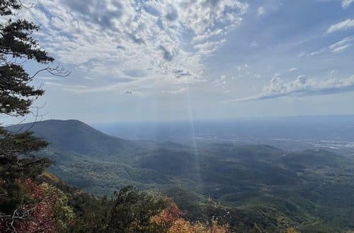
On the way down the trail, there are beautiful mountain and forest views.
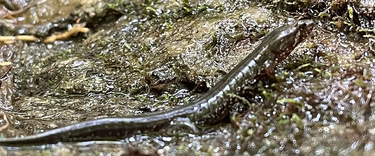
You may be thinking that you won’t get much of the park experience by going down a .3-mile trail. But if you take your time and look around, that is actually not the case at all. On the way down the trail, there are beautiful mountain and forest views. There is an old truck from the 1950s stuck in the trees, and if you aren’t looking you will miss it! There is also a rocky face that Jesse and I spent so much time at. If you are just hiking by, all you will see is a rocky face with water streams going over it. But if you take a moment to look, there are actually tons of salamanders throughout the rock crevices. We also found a crawfish at the base of the rock! We also found more salamanders on other parts of the trail and on the waterfall.
The trail dead ends at Amicalola Falls. There is a platform that is located right in front of this midsection of the falls. This is probably one of the best spots to see the waterfall. It was very crowded, but it makes sense why so many people want to see it! The waterfall is just so pretty.
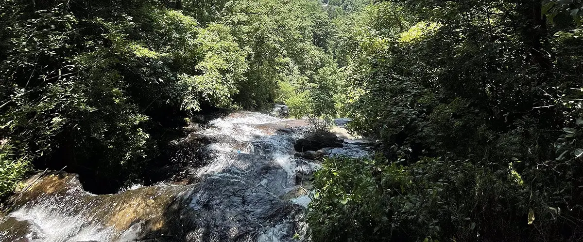
When you are done looking at the waterfall, you can continue to walk down the trail and go down the stairs onto the Base-of-the-Falls Trail. Or you can backtrack a little bit and go up the West Ridge Staircase, straight up to the Top-of-the-Falls area. We opted for neither of those and went back to our car. We continued to drive up the mountain where we parked at the Top-of-the-Falls area. There is a little bridge that goes over the creek as it turns into the waterfall. This spot is also a can’t-miss area of the park.
Next, we drove back down the mountain to the Visitor Center area. Once you reach the stop sign at the bottom, take a left and drive all the way to the end of the road to the Reflection Pond. This pond is part of Amicalola Creek. Here, you can sit next to the pond, or you can get out and walk along the creek. We found more crawfish and salamanders here as well.
One of my favorite things about Amicalola State Park is that it is so accessible.
One of my favorite things about Amicalola Falls State Park is that it is so accessible. You can drive to different parts of the waterfall, go down a wheelchair accessible trail, and you can tweak your trip to your needs. Amicalola Falls Hikes are widely available, with plenty of trails for every visitor. I appreciate how much Georgia is working to get everyone outdoors. Amicalola is a testament of this work.
After our visit to Amicalola Falls State Park, we decided to take the 23-mile drive over to Talking Rock, Georgia to visit Talking Rock Brewery!
Happy Trails,
Katie & Jesse
Tips for your trip to Amicalola Falls State Park
- Amicalola is a great place to visit for all types of families, ages, and abilities! You can drive to different spots throughout the park and see the waterfall without hiking (or a very short hike).
- The Visitor Center here is so cool! There is a little cafe, information about the park’s history, and many live snakes and turtles!
- Remember to be bear aware at Amicalola Falls State Park. The American Black Bear has been spotted in this Georgia State Park. Don’t feed the bears, even if they are cute!
- Parts of Amicalola are more dog friendly than others. When we were there, a family tried to walk their golden retriever down one of the waterfall trail staircases. These staircases are metal grates, so it may be uncomfortable for your dog. The family ended up having to find a different spot to take their dog, because he refused to go down the stairs.
- Please pick up your trash! And please educate your children about not littering! While we were near the creek, we watched a child throw a dirty diaper into the creek and out of reach of it getting picked up.
- We also found old fishing lines (one had a lure with a baby dead trout on it) in the creek. I know it is easier said than done, but please try your best to collect your fishing line and lures.
- Amicalola Falls is a very popular state park. If you are going on the weekend or during the fall, be aware that it will most likely be crowded.
Places to stay Near Amicalola State Park
- Camping at Amicalola State Park: There are 24 wooded campsites accommodating tent camping or RVs at this state park. There are also four glamping sites available. View more information about campsites, availability, and reservations.
- Cabins located in Amicalola State Park: There are 14 cabins available at this state park. View more information about the cabins and reservations.
- Lodging in the park: Amicalola State Park Lodge is a modern hotel located near the top of the falls. View Lodge details and reservation information. Note: We suggest checking rates and availability for the Lodge on Expedia.
Amicalola State Park Information
- Amicalola Falls State Park Trail Map: Original Trail Map – Click to View (pdf)
- Amicalola Falls State Park Map: Click to View (pdf)
- Park Hours: Amicalola Falls State Park is accessible year-round during daylight hours.
- Visitor Center Hours:
Monday – Thursday from 8:00 a.m. – 5:00 p.m.
Friday – Sunday from 8:00 a.m. – 6:00 p.m. - Parking: $5 per vehicle per day. Annual passes available.
- Phone Number: 706-344-1500
- Address: 280 Amicalola Falls State Park Road, Dawsonville, GA 30534
- GPS Coordinates: N 34.562652 | W -84.247627
- Directions to Amicalola State Park: View this Google Map to determine directions to the park from your location.
Amicalola Falls State Park has a significant commercial presence.
While Amicalola Falls State Park falls under authority of the Georgia Department of Natural Resources, the park and its lodge are managed and operated by the North Georgia Mountains Authority and Coral Hospitality.


