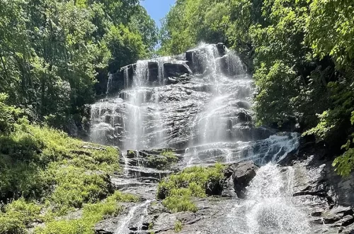
Fall Creek Falls State Park
Back in August, Jesse and I traveled north to Fall Creek Falls State Park located in Spencer, Tennessee. This state park is one of the largest and most popular in Tennessee. This park is in the Cumberland Plateau region and located southeast of Rock Island State Park and northeast of Savage Gulf State Park.
First thing to do is find the Fall Creek Falls State Park Visitors Center so you can get a map to navigate around the park.
Fall Creek Falls is a massive state park – 29,800 acres! There is a golf course, a visitors center, nature center, cabins, a pool, a lake, camping, a scenic driving route, and a lodge with a restaurant. Once you enter the park, the first thing to do is find the visitors center so you can get a map to navigate around the park.
After going to the visitors’ center and grabbing a map, we drove to the Fall Creek Falls overlook and trailhead. The park roads are marked well, and it was not hard to find this area. At the viewing area, you see not only the park’s namesake waterfall, but a large canyon. The waterfall is 256 feet high. After taking a few photos, we decided we would start our hike from the overlook.
Our goal was to make a loop going from Fall Creek Falls to the nature center and back. This was one of the best decisions we made on this trip (and trust me, you’ll want to as well!). The reason is because the nature center is the perfect midpoint in the hike to take a break! More on that later.
Jesse and I followed the brown trail on the map to the nature center. If you are starting from the viewing area at the falls, you need to take the trail to the right, and there will be a few signs that also say, “to nature center.” Parts of the trail were paved on the way to the visitors’ center, but not all of it to where it could be wheelchair accessible. While hiking, we passed over a creek with a bridge and saw a few deer.
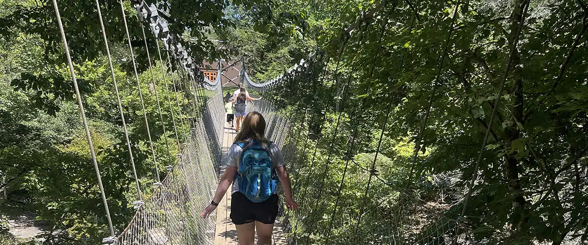
The trail from the overlook to the nature center is only .9 miles. It is brown on the map and is called the Woodland Trail. However, there is a good mix of uphill and downhill, so it feels longer than that. Towards the end of the .9 miles, all of a sudden there will be a circular clearing in the woods and a concrete staircase. After going down the staircase, you will see a long suspension bridge. Cross that bridge and you’ve made it to the nature center!
Go down the wooden staircase and take a look at the Cane Creek Cascades and the little canyon that is carved out from the creek.
The Cane Creek Cascades are located at the nature center, too. I suggest going through the nature center first, cool down, go to the bathroom, and then get back outside and take a look at the cascades. People were swimming in the water in this part of the creek, which is another great cool down option. Even if you aren’t going to swim, at least go down the wooden staircase and take a look at the cascades and the little canyon that is carved out from the creek. It is so pretty at this location.
If you would rather park at the nature center and walk to the Fall Creek Falls overlook, you definitely can! However, there will not be the same cool down options as there are if you do the nature center as the middle half of your hiking loop.
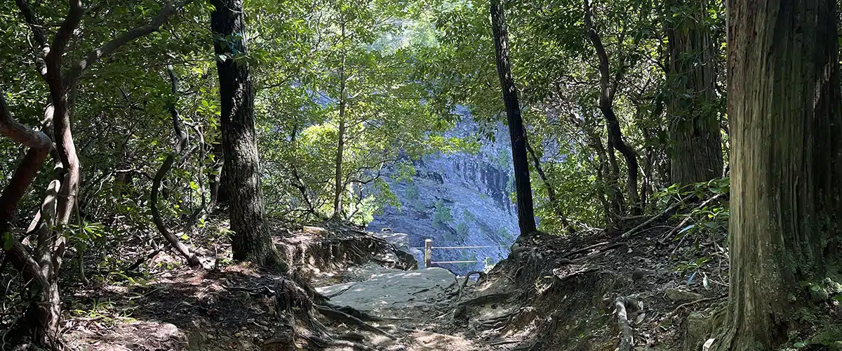
After we were done at the nature center and cascades, we went back across the bridge and back to the .9 trail back to the overlook. About .15 miles back down the Woodland trail (brown trail), there is a split in the trail. We took the split and went on the Overlook trail (black on the map). This made our trip just a little bit longer because there are at least 3 different overlook spurs that branch off the Overlook trail. This is worth it! There are some crazy gorge views and rock formations. Most of these overlook spurs are steep and rocky, however they are very short.
We definitely recommend taking this on your way back to see some different areas of the park. Plus, it still takes you to the original location of the Fall Creek Falls overlook and parking lot.
After hiking, we drove on the scenic drive loop. This loop isn’t very long, maybe around 6 miles. However, there are excellent views and overlooks! It is also a great way for those who can’t hike to see the picturesque features of the park.
Our last suggestion for your trip is something that you would never see while looking on the park map. We didn’t even know we were going to drive by it, and we got lucky because the directions for the brewery we were going to had us use a different park entry than the first one:
On the park map, there is a picnic area labeled “3.” It is next to the label for the street name “Village Camp Rd.” Go here! Even if you are on the other side of the park, get in the car and drive here! There is a sharp downhill turn with parking on one side. The other side is grassy and there is a large creek. This is picnic area 3 and it is part of the George Hole Swimming Area. The creek is Cane Creek. This was such a pretty location. Words cannot do it justice.
Along the creek is a rock wall with a few small caves, characteristic of the Cumberland Plateau region of Tennessee. Part of the creek is dammed here, which makes it ideal for swimming. You can walk along the creek past the dam and find more scenic spots to sit by the creek. This was one of my favorite spots in the park. Make sure you swing by on your visit!
After our trip to Fall Creek Falls State Park, we headed to the original location of Monkey Town Brewing in Dayton, Tennessee.
Tips for your trip to Fall Creek Falls State Park:
- For a nice break on your hike, go Fall Creek Falls overlook -> nature center (woodland trail) -> overlook trail -> Fall Creek Falls overlook
- Make sure you have a park map! Whether it is on your phone or a paper copy, it will come in handy. This state park is too big to just guess where you are.
- If you can’t hike, the nature center and the scenic drive are accessible! We are huge fans of parks that still have accessible options for visitors.
- If you don’t necessarily want to drive 38 miles for a brewery, try to not go on a Sunday because many places will be closed. However, Monkey Town is always worth the drive!
- The overlook trail’s overlooks are blazed blue. Definitely go down these if you can!
- Take some good hiking shoes with you. There are some very rocky and rooty parts of the trails.
Places to stay Near Fall Creek Falls State Park
- Camping at Fall Creek Falls State Park: There are 202 campsites in five different areas campsites accommodating tent camping or RVs at this state park. View more information about campsites, availability, and reservations.
- Cabins located in Fall Creek Falls State Park: There are several cabins available at this state park. View more information about the cabins and reservations.
- Lodging in the park: The Lodge at Fall Creek Falls State Park Lodge is a modern hotel located within the park. View Lodge details and reservation information.
- View more places to stay near Fall Creek Falls.
Fall Creek Falls State Park Information
- Fall Creek Falls State Park Trail Map: Click to View (pdf)
- Park Hours: Fall Creek Falls State Park is open 24 hours with the road leading to the falls being locked at dark. All Day Use Areas close at sunset.
Visitor Center Hours: There are several centers in the park. View hours for each center. - Parking: $5 per vehicle per day. Annual passes available.
- Phone Number: 423-881-5298
- Address: 2536 Lakeside Drive, Spencer, TN 38585
- GPS Coordinates: N 35.655 | W -85.356
- Directions to Fall Creek Falls State Park: View this Google Map to determine directions to the park from your location.


