Keown Falls Trail
It looked like this waterfall hike had a lot to offer – and I am so happy we went!
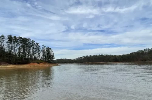
In the winter of 2025, Jesse and I traveled to the Chattahoochee-Oconee National Forest near LaFayette, GA. In this National Forest is Keown Falls Recreation Area. This is a remote area, but keep driving, and you will find a forest service road marked as “Keown Falls Trailhead.”
I had actually seen a video about this trail on Instagram. I knew that this waterfall hike wasn’t going to lead to a giant cascading waterfall like you see at Amicalola or Anna Ruby Falls. But it looked like this waterfall hike still had a lot to offer – and I am so happy we went!
After parking in the small trailhead lot, you will start off on the blue blazed trail. The first little section of this trail is gravel and lined with rocks – but don’t be deceived, the trail changes pretty quickly after that. There is a small creek crossing (very manageable with plenty of rocks to hop across) and then the trail starts going uphill. At this point, you are starting your ascent up Johns Mountain. Luckily, the trail slowly winds up the mountain instead of going straight up hill. Even though this is an “easier” uphill hike, you still feel it on the way up!
As you get closer to the mountain top, patches of trees start to clear out, allowing for amazing views of the surrounding area. Keown Falls is located in Georgia’s Ridge and Valley region. This is one of my favorite Georgia regions. It is characterized by deep valleys and long, high mountain-like ridges. But instead of having pointed tops like other mountains, the ridges have flat tops. There is also a lot of rocky terrain, perfect for waterfalls. This trail gives great views of the surrounding ridges and valleys!
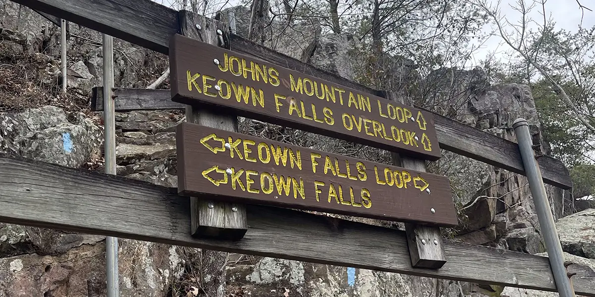
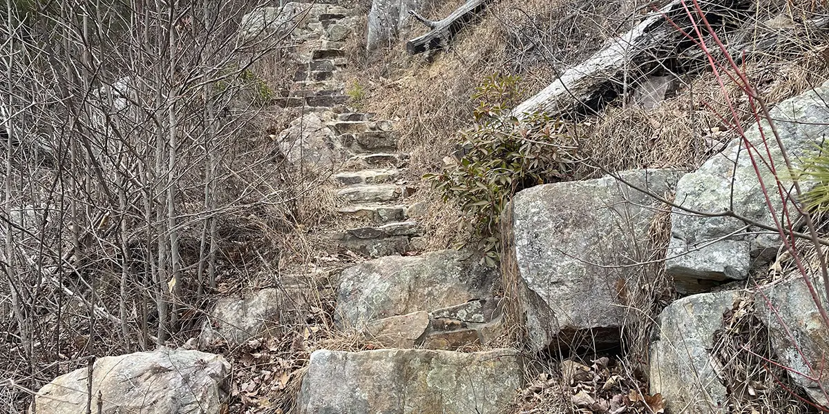
Just over a mile or so up the trail, you come across a steep rocky staircase. Go up these stairs (and watch your step) and you will see a set of signs:
JOHNS MOUNTAIN LOOP⬆️
KEOWN FALLS OVERLOOK⬆️
⬅️KEOWN FALLS LOOP➡️
⬅️KEOWN FALLS
We continued to Keown Falls. The waterfall is actually very tall, but the water flow is low (kind of like rain). The area behind the waterfall is accessible to walk around in. Definitely go explore this area! It is an open cave-like area. This hike was in late January in Northwest Georgia, and it was a very cold day. Massive icicles were hanging from the cave top. There were also cool ice formations amongst the cave rocks.
We actually had every intention of completing the Keown Falls Loop, but to continue, we had to walk on a part of the trail that had thick ice and was slightly uphill. This did not seem like the best idea for us at the time because we had both of our dogs with us.
After exploring the Keown Falls cave area, we backtracked to the staircase area and hiked up to the Keown Falls Overlook. Don’t miss this! This large deck offers awesome aerial views of the waterfall and the surrounding areas
We really enjoyed this hike! It was easy, dog friendly, and the views were awesome.
At this point, we turned back around and hiked back down Johns Mountain. The hike was 2.26 miles and took us 1 hour and 24 minutes. We had a total elevation gain of 527 feet. We really enjoyed this hike! It was easy, dog friendly, and the views were awesome. The forest was also very beautiful. Consider going in the winter, too! This time of year provides different views because the leaves are off the trees and there is the possibility of seeing the waterfall covered in ice. We are looking forward to returning in the spring.
After the hike, we carried out our tradition of finding a brewery for a post-hike beer. The part of the Chattahoochee-Oconee National Forest we were in was in the middle of nowhere. We drove about 30 minutes to get to downtown Calhoun, the location of Heavale Brewing Company.
Tips for your trip:
- It is hard to find an exact address for Keown Falls. Make sure you have the route to the trailhead’s coordinates loaded before you get close to the National Forest area – you probably won’t have service!
- The trailhead offers vault bathrooms. If that isn’t your thing, make sure you go before you get there or be prepared to hold it!
- The trailhead has picnic tables.
- The trail is dog friendly.
- If you want to go on a longer hike, you can expand your hike to the Johns Mountain loop. It circles back around to the Keown Falls Loop.
- There is no drinking water available at Keown Falls Recreation area. There is one “vault” style bathroom.
Happy Trails!
Katie & Jesse
Keown Falls Recreation Area Information
- Hours: Day-use area open year-round.
- Entry fees: Free, no entry fees.
- Camping: There are no camping facilities at this day-use recreation area.
- Driving Directions: From I-75 Exit 320 near Resaca, GA, go west on highway 136 for 7 miles. At stop sign, turn right to stay on highway 136 for another 7 miles. Turn left on Pocket County Road and continue for 5 miles. Turn right on Forest Service Road 702 and proceed 0.6 miles to picnic area. Also view this Google Map
- Geo Coordinates: Latitude 34° 36′ 48.9132″ N | Longitude 85° 5′ 17.1708″ W
Last Updated on July 1, 2026


More to Explore
Great Smoky Mountains National Park

Sweetwater Brewing Company