North Chickamauga Creek Gorge State Park
This Tennessee state park was originally a state natural area but was changed to a state park in September 2024.
In mid-November, Jesse and I traveled north to Tennessee’s newest state park: North Chickamauga Creek Gorge State Park. This state park was originally a state natural area but was changed to a state park in September 2024. In fact, if you research the park, much of the information still calls it a state natural area. The main trailhead is located in Soddy Daisy, only 16 miles from Chattanooga.
As you drive to the main trailhead, you will go through the small town of Soddy Daisy and residential areas. Just keep following your GPS! Once you get past homes, you will turn onto a mountain road and the trailhead lot will come up quick.
The main trail head has a large gravel lot that is in different sections. You know you are in the right place when you see the large state park sign. There is no bathroom and no visitor’s center. According to the Tennessee State Parks website, there are future plans to build a visitor’s center and even an ADA viewing platform! When we arrived, there was also a park ranger sitting in a truck – be aware that even though this state park feels remote, it is monitored. Before you hit the trail, there is a large map to take a picture of, or downloaded the North Chickamauga Creek Gorge State Park trail map from the TN State Parks website.

We decided we wanted to do a hike that was a little more challenging. We decided to hike Hogskin Loop, go down to the creek, hike the one-way trail to Blue Hole, and then turn around and finish the loop at the main trailhead. Hogskin loop is only 1.55 miles, however, it is very rocky and pretty challenging.
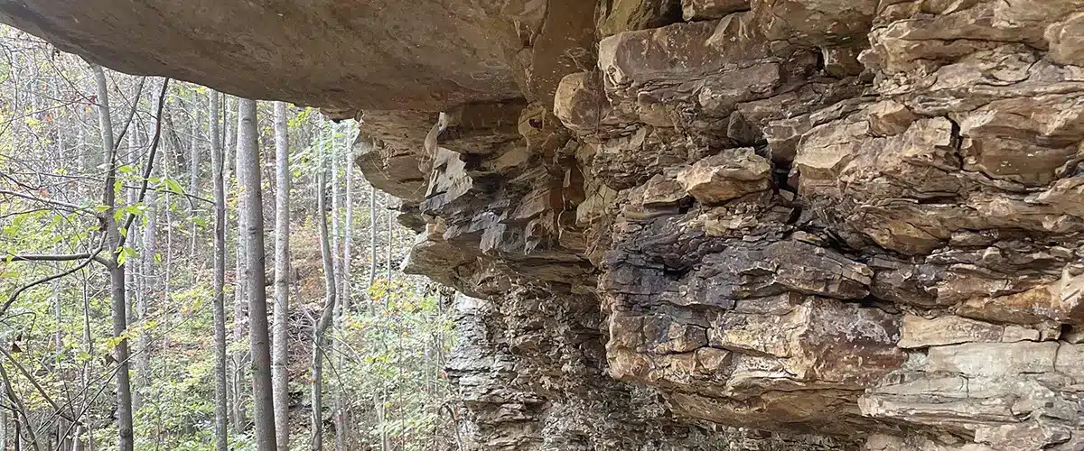
Whenever we hike in the Cumberland Plateau region of Tennessee, I am always amazed at the rock formations on the trails.
At the main trailhead, walk past the large state park sign (you will know it when you see it, it is actually a really cool sign!) and follow the path to a trail sign. This sign gives you five options: Hogskin Branch Loop, Blue Hole, Boston Branch Overlook, Cumberland Trail, and Stripmine Falls. We took the Hogskin trail to the right, which immediately went uphill with very rocky terrain. However, we did want a challenge!
Hogskin Branch Loop is full of rocky steps, mountain views, rock formations, and scurrying chipmunks and squirrels. Whenever we hike in the Cumberland Plateau region of Tennessee, I am always amazed at the rock formations on the trails. It is so different from many of the Georgia trails we hike. This park (as you can tell from the name) is located in a gorge that is made by North Chickamauga Creek. This also makes for great views.
As you keep hiking on the trail, you will come across a small hillside stream that turns into a rocky waterfall. It isn’t a high-volume waterfall, especially because when we went there hadn’t been much rainfall, but it is a tall one. Definitely take a moment to explore while you are there!
As you get around the halfway part of the loop and curve back down into the gorge, there are some areas that are very rocky, and it is hard to tell where the trail is. Be diligent, watch your step, and look for the red trail blazes. As you approach the creek at the bottom of the gorge, you will come across and informational sign. Here you will see the starting point for Blue Hole trail. There will be a wooden gate leading to the creek – walk through that and down to the creek.
This creek crossing isn’t the hardest thing in the world, but one wrong step and you can ruin your hike with a broken leg.
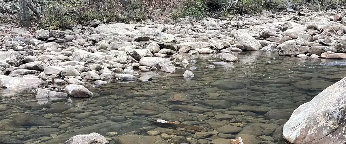
Here is where you will make a decision: “Do I do this large rocky creek crossing or do I keep walking the Hogskin loop back to the car?” Do it if you can! We went at a time of little rainfall, so that helped when it came to crossing the creek. But if rock hopping is not your thing or if the rocks are too slick or if the creek is high, then really think about if you should do the creek crossing. No, I am not trying to be a buzzkill. This creek crossing isn’t the hardest thing in the world, but one wrong step and you can ruin your hike with a broken leg. I am speaking from the POV of a former Park Ranger, and I know from experience how easy a misstep can mess up your hike! Ok, rambling over – just make a decision that is best for you!

If you choose to cross the creek and complete the Blue Hole trail, it is worth it. This trail walks right alongside the rocky North Chickamauga Creek and gives you perfect views of the gorge. This is not a long trail, only .75 miles. When you reach the end, you have arrived at Blue Hole. This is a slower part of the creek that has a large swimming hole. During the summer, this is a popular place to visit. The water here is so clear that you can see straight to the bottom of the Blue Hole. There are also massive rocks to take a break on (or have a picnic on!). This was one of my favorite areas in the park.
After exploring the Blue Hole area, we hiked back down the trail, back over the creek, and what remained of Hogskin Loop to the parking lot. The rest of Hogskin Loop back to the parking lot thankfully is pretty tame. I definitely recommend the route we went because we were able to hike the more challenging parts going downhill. This total 3.34-mile hike took us just over two hours. When we went in November, the leaves were beautiful, and the temperature was perfect for hiking.
After our hike, we headed to Chattanooga to grab a few beers at Oddstory Brewing Company.
Tips for your trip to North Chickamauga Creek Gorge State Park
- There are NO bathrooms at North Chickamauga Creek Gorge State Park – make sure you go before you hike or be prepared to pee in the woods!
- The rock formations are very cool at North Chickamauga Creek but be careful – when we were looking at one, some rocks broke off on their own and almost hit us in the head.
- Be careful and take your time on the rocks when you go through the creek.
- As of now, North Chickamauga Creek State Park does not have any ADA accessible trails or overlooks.
- Go to the park during the fall for great fall colors!
- If you visit the Blue Hole trail during the summer months you can bring a swimming suit and enjoy the refreshing blue water.
Happy Trails,
Katie & Jesse
Places to Stay Near North Chickamauga Creek Gorge State Park
- Camping at North Chickamauga Creek Gorge State Park: Only hike-in tent campsites are currently available. View more information about campsites, availability, and reservations.
- Hotels and cabins nearby: View places to stay near Fall Creek Falls.
North Chickamauga Creek Gorge State Park Information
- Trail Map: North Chickamauga Creek Gorge State Park Trails – Click to View
- Park Hours: 8:00 AM – 7:00 PM Daily
- Phone Number: 423-708-8313
- Address: 354 Montlake Road, Soddy Daisy, TN 37379
- Directions to North Chickamauga Creek Gorge State Park: View this Google Map to determine directions to the park from your location.


