High Falls State Park
High Falls State Park is known for its large cascades along the Towaliga River
In mid-July, Jesse and I took a trip to High Falls State Park. Well, it was more than a trip – it was a camping weekend full of hiking, campfires, fishing, and of course, good beer. Jesse and I last went camping at High Falls State Park in September of 2022, so it had been a while since our last visit. For three years we kept trying to book a site here, but due to timing and campsite availability, we were always out of luck. Finally, the right time and the perfect campsite coincided, and we were able to go back!
On this camping trip we made sure to book a site next to the previous site we had there. In our opinion, the perfect site is #88. This site is special for multiple reasons:
- There is plenty of room on this site for at least two cars. It can allow for a 50-foot camper as well.
- The campsite has a strip of woods on one side so that you aren’t right next to neighbors. This is ideal for us since we have dogs that love to bark!
- The campsite is a short walk to the bathhouse.
- And most importantly, this site has a direct trail to the Towaliga River. This is one of my favorite things about this park. Here, we were able to fish just steps from our campsite. We also set up chairs and hung out by the river. Our dogs were able to enjoy some water time. This part of the river has fairly clear water and is not that deep – four feet at the most in some areas. It’s perfect for wading in and throwing your line out! This is hands-down as one of the best spots in the park.
This site is located in the river camping area, specifically on Loop D. Other areas are more in the woods and do have river access, but when driving around we still found that this is our favorite. There is a campground located next to High Falls Lake and paddle-in pioneer camping is available as well.
We decided to hike the Falls View Trail
Besides hanging by the river and fishing, we went hiking. High Falls State Park is known for its large cascades along the Towaliga River. In the early 1800s, High Falls was home to a little town that had a grist mill, cotton gin, and even a shoe factory. Industrial towns of this era were typically set up along rivers with large rapids and cascades to harness the hydroelectricity (see Sweetwater Creek State Park and Roswell Mill Waterfall). In addition to the large rapids and cascading waterfalls, there is an old dam that also has water flowing over it. So, if you love waterfalls, this is a great park for you!

To get the best view of the Towaliga River’s waterfalls and the dam, we decided to hike the Falls View Trail. This trail is only 1.5 miles round trip and according to the State Park it is a strenuous hike. This trail is not accessible – the trail starts with stairs. However, the dam can be seen from the visitor center and is accessible for viewing.
We visited this park in July – if you know anything about the South, you know that a Georgia July is going to be very hot and very humid. We saw people taking their dogs on this trail, but we opted to let the pups stay in the camper A/C. It was a good thing we did, too, because we just about melted out there!
The Falls View Trail follows along the Towaliga River is a double loop trail. On this section of the river, it is flowing downhill over rapids. So, the first part of your hike will be going downhill and going downstairs (you know what that means for your hike back! Ha ha). The trail is very rocky and rooty, so make sure you watch your step. The trail also has awesome observation decks that get you close to the waterfalls and cascades.

Eventually the trail will split, taking you on a loop through the forest. If it is too hot, you can continue on the first loop and get back to the parking lot. If you can, definitely keep going and complete the second loop. It follows through the woods and along the river some more.
There were tons of mushrooms, wildflowers, vegetation and boulders that are characteristic of the geological and biological diversity of Georgia’s Piedmont region.

This trail is marked, but sometimes it is confusing. Trail markers would be stacked on top of each other, with one arrow going left and the other arrow going right. I realize this is because there are two loops, however some parts of the trail were still a little difficult to tell which way the way was to continue on. Sometimes we felt like we were in Wonderland with the different arrow signs! Definitely take a trail map or screenshot it on your phone. This isn’t a long trail, and you probably won’t get lost, but if it is too hot and you realize you need to go back to the car, it is nice to have a map.
This hike took us about an hour to do. We frequently stopped for water breaks because of how hot it was. We also took frequent stops so I could take mushroom and wildflower photos. Once again, this trail is strenuous. But, if you can do it, do it! It is so worth it. This is the largest waterfall south of Atlanta, and getting to hike alongside it is a treat.

After our hike, we went back to the campsite, cleaned up, and typed into Google “breweries near me.” Our trusty search phrase led us to Piedmont Brewery in Griffin.
Happy Trails!
Katie & Jesse
Tips for your trip to High Falls State Park:
- If you are visiting High Falls State Park for a summer hike, make sure you bring a lot of water.
- We saw hikers on the Falls View trail with dogs. This trail is steep, has stairs, and it can be very rocky in some areas. We also went when it was very hot. Honestly, those dogs looked miserable. Please, if your dog can’t handle a difficult hike in the heat, don’t bring them along. I love hiking with our dogs, but their well being comes first!
- Bring a pair of binoculars on the hike to spot some birds!
- The best fishing we found at High Falls was on the bank of the Towaliga River in the old powerhouse area. We caught some good sized fish there!
- If camping, try to book a site near the river.
Bring a map on your hike so you don’t get turned around on the trail. - Do not pick wildflowers! Keep an eye on your kids and make sure they don’t either!
- If camping at High Falls, there are no major stores nearby. There is a Dollar General and a few gas stations, just an FYI.
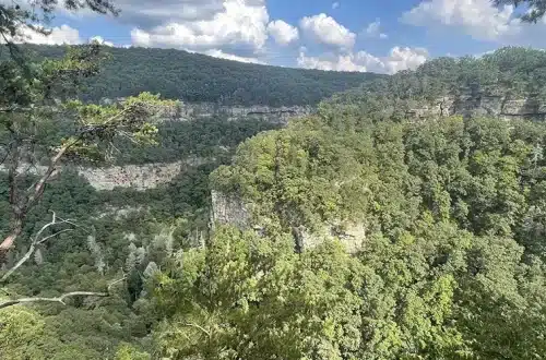
- Once you’ve explored the waterfalls at High Falls, consider heading south to the Providence Canyon ‘Little Grand Canyon’ hikes for bright canyon walls, rim overlooks, and short but scenic loop trails.
High Falls State Park Information
- Address: 76 High Falls Park Drive, Jackson, GA 30233 (Google Map)
- Phone: +1-478-993-3053
- Hours: Park – 7:00 am – 10:00 pm, Office – 8:00 am – 5:00 pm
- GPS Coordinates: N 33.178333 | W -084.020533
- Website: High Falls State Park
- Stay near High Falls State Park: Find hotels and lodging options
Last Updated on January 10, 2026